- CONTACT -
“Cappadocia” is a geographical name that refers to this region; it’s not a specific town or village. It spreads over five current-day provinces; the very center of it is in Nevsehir province, with ÜrgÜp as its main town and county. For reference, Cappadocia just slightly smaller than Yellowstone National Park, one of the largest parks in the United States.
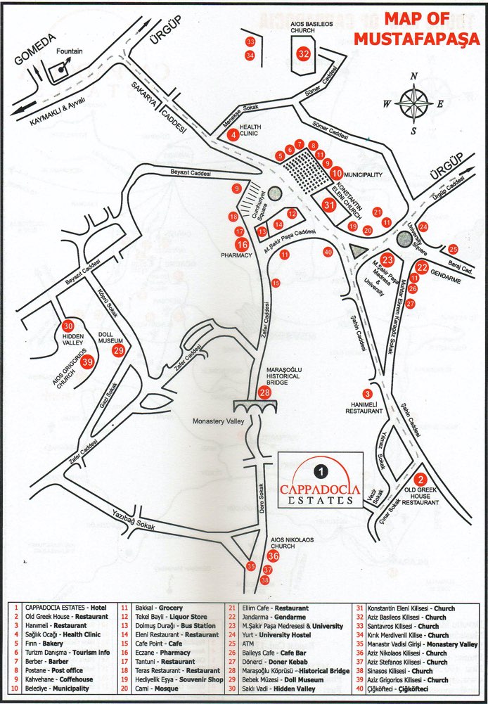
Cappadocia Estates is at the heart of the Cappadocia region, 5 km/3 miles south of Urgup in the village of Mustafapasa – historically known as Sinasos. This village is a protected urban preservation site.
Coordinates:
Latitude - 38 34 51.80 (38.581056)
Longitude - 34 53 55.38 (34.898717)
Distance to Regional Attractions:
Goreme Open Air Museum – 13 km/ 8 miles
Uchisar Castle – 19 km/ 12 miles
Avanos – 19 km/ 12 miles
Kaymaklı Underground City – 30 km/ 19 miles
Distance to Airports:
Goreme Open Air Museum – 13 km/ 8 miles
Nevsehir Kapadokya Airport (NAV) – 49 km/ 30.5 miles
Kayseri Airport (ASR) – 75 km/ 47 miles
Ankara Esenboga Airport (ESB) – 290 km/ 181 miles